Horseback Riding Trails New York!
State Parks – Official Page Link – Trail Map Link
- Allegany State Park – Trail Map – Parking GPS
- Backbone Horse Camp – Trail Map – Parking GPS
- Boutewell Hill State Forest – Trail Map
- Boyce Hill State Forest – Trail Map – Parking GPS
- Carlton Hill State Forest – Trail Map
- Darien Lakes State Park – Trail Map
- Elkdale State Forest – Trail Map
- Finger Lakes National Forest – See Backbone Horse Camp
- High Tor State Forest – Trail Map
- Knox Farm State Park – Trail Map
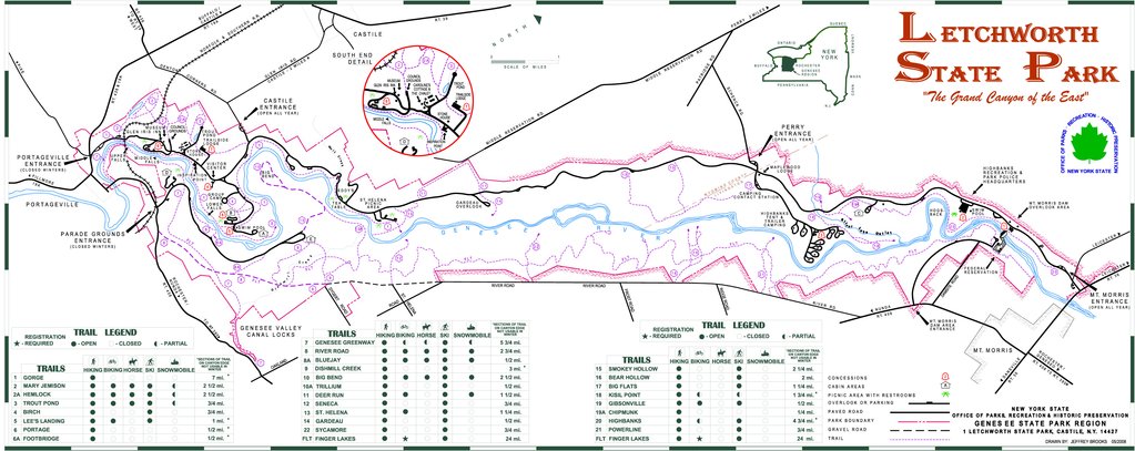
- Letchworth State Park – Trail Map
- North Harmony State Forest – Trail Map
- Ossian State Forest – Trail Map
- Philips Creek State Forest – Trail Map
- Pine Hill Equestrian Trails – Trail Map
- Rattlesnake Hill Wildlife Management Area – Trail Map
- Sonyea State Forest – Trail Map
County Parks – Official Page Link – Trail Map Link – Trailer Parking GPS
- Black Creek Park – Trail Map – Parking GPS
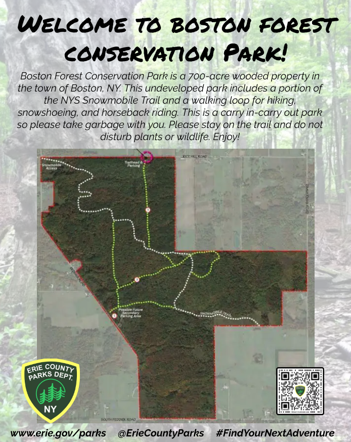
- Boston Forest County Park – Trail Map – Parking GPS
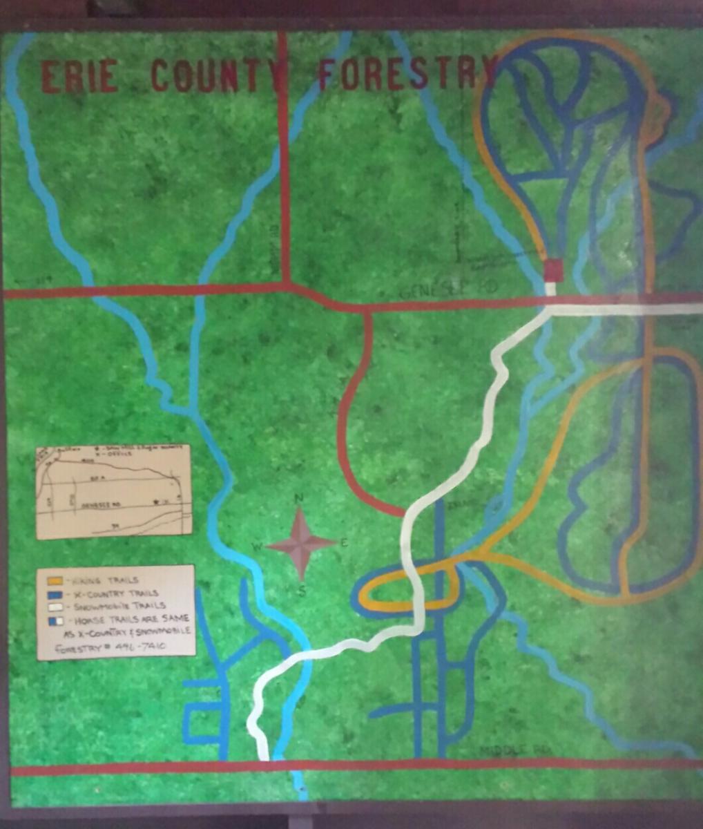
- Erie County Forest – Trail Map – Parking GPS
- Genesee County Park and Forest – Trail Map – Parking GPS
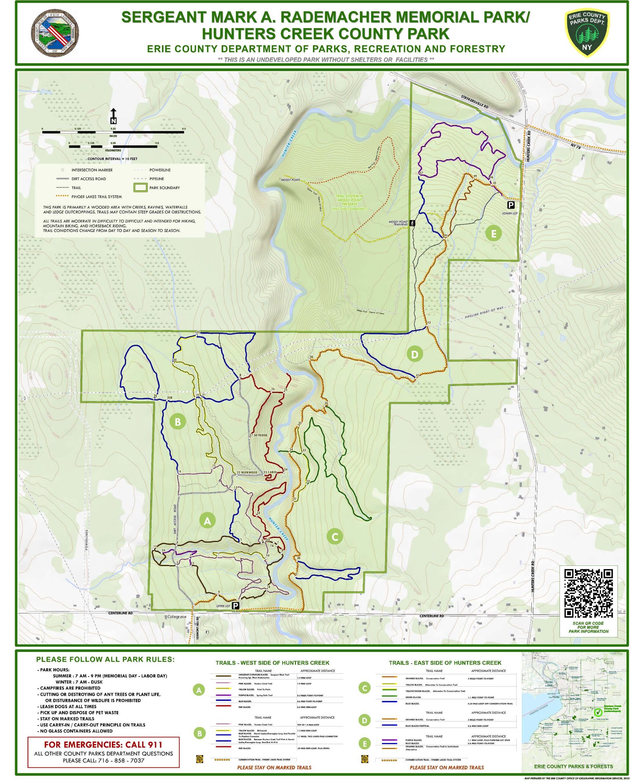
- Hunters Creek County Forest – Trail Map – Parking GPS
- Mendon Ponds Park – Trail Map – Parking GPS
- Northampton Park – Trail Map – Parking GPS
- Oatka Creek Park – Trail Map – Parking GPS
- Webster Park – Trail Map – Parking GPS
Greenways (Rail to Trail) – Official Page Link – Trail Map Link
- Auburn Trail – Trail Map
- Erie-Attica Trail – Trail Map
- Genesee Valley Greenway – Trail Map
- Keuka Outlet Trail – Trail Map
- Lehigh Valley Trail – Trail Map
- Ontario County Pathways – Trail Map
- WAG Trail – Trail Map
NEW Google Map
Click Here to view Rochester Trail Riders Map on Google Maps on your Cell Phone.